You Thought YOUR Permitting Was Challenging?
Marine Surveys Optimize Routes for Undersea Cable Protection While Respecting Needs of Other Sea Users —
99% of international data is transmitted through subsea cables. Contrary to popular misconceptions about satellites, the data you’re using to read this article right now is almost surely via a subsea cable — transmitted up to 8 times faster than via satellite.
It stands to reason, then, that laying advanced, reliable cable with a long lifespan is critical to
maintaining and securely increasing the world’s bandwidth. But this is far from being an easy feat.
Where there are massive populations, there are massive needs for bandwidth, and thus the need for cable and landing stations. But it is these populous areas that also create incredible challenges for cable layers.
Where these vital links are required, there are busy shipping channels as well, pipelines and other cables to cross, landing at potentially highly populated or touristic beaches, historic fishing areas, offshore wind farms, aggregate dredging, nature conservation areas designated for their seabed features and fish spawning grounds, even unexploded ordnance from decades of wars and shipwrecks — more common than you’d think!
With just about every possible obstruction for an undersea cable to route around, it takes an expert team to develop the right route for a long-lasting cable.
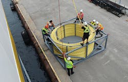
Overseeing spare cable transfer.
The Necessity of Cable Burial
One of the best ways to protect a cable is by burying it along the seafloor. Burial is in the interest of the cable developer (to protect the asset), but also of great concern to permitting authorities, as suspensions can pose a hazard to fishing through the risk of entanglement with any bottom-contact mobile gear.
When planning for cable burial, significant study is required to select a route where target burial depths can be achieved.
The first step is conducting a desk-based study, using all the best available scientific data on sediments and geological features. The best-case scenario is laying a cable in a well-researched area with existing detailed charts and data points upon which to base decisions.
The next step is to conduct the survey, which is used to confirm the desk-based evidence. The survey requires advanced geotechnical equipment, such as core penetration tests and grab sampling to determine the make-up of seabed sediments, ensuring avoidance of hard sediments such as clay and chalk; and geophysical equipment: a sub-bottom profiler to determine the depth of sediment, and multibeam, acoustic sidescan and magnetometers to indicate surface objects, areas of bedrock and other geological features that could make burial difficult, such as exposed rock or sandwaves.
Desk-based analysis of the survey data by a team of geophysicists follows; they are responsible for adjusting the route design to avoid any features that would make plow burial difficult.
Fishing Interactions
In heavily populated areas, one must consider the impacts on static fishing gear (pots and nets).
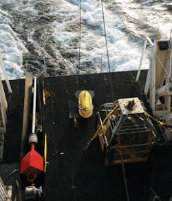
Subsea survey equipment being prepared for deployment.
Prior to installation, developers need to consider interactions and impacts to bottom-contact mobile gear (dredges and trawls). Ensuring the safety of fishing operations is paramount to many permitting countries, so it’s important to use the best available data on fishing activity to route around the more intensively fished areas, therefore reducing the risk of entanglement to low or negligible levels. Many jurisdictions make resources for such planning readily available. For example, the European Union has a long-established framework for collecting fisheries data, and most Member States make it easy for developers to use this data so it’s possible to see where interactions are likely to cause problems.
In order to keep the survey process on budget by reducing vessel days, the most common approach is to appoint a Fisheries Liaison Officer (FLO). A FLO helps facilitate communication with the fishing industry and ensure that routes are clear of static gear. In order to protect fishing activities, many jurisdictions require that advance notice (5 days and even more) of block-by-block survey plans annotated onto a navigation chart be delivered to local fishing associations.
Despite good communications between the FLO and fishing communities, there’s still a high likelihood of survey vessels coming across gear on the route, which can lead to delays in the survey. When this occurs, FLOs must have a strategy and budget for compensating fishermen for damaged gear, and for keeping the project team up-to-date with gear movements and liaison activities.
Permitting
Permitting, in a nutshell, is making sure the authorities are satisfied that there are no significant environmental or health and safety impacts throughout the project — from survey, to installation, to maintenance, right through operations, to decommissioning. Developers must demonstrate that they’ve gone through due process and have considered all worst-case scenarios.
Surveys are a licensable activity in many countries. Many authorities require survey proposals
for every subsea cable project to ensure that all stakeholders have an opportunity to comment.
The final decision considers the impact on all interested parties. In most cases, survey permits require some level of evidence of stakeholder engagement (such as email correspondence with other cable owners), detailed design-of-works to be carried out, accurate location information, timescale and criticality of works, and an estimate of potential wider impact on the marine environment, like seabed habitats in designated conservation areas.
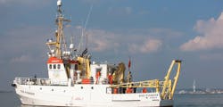
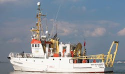
The EGS Pioneer, deployed to survey subsea terrain prior to cable laying.
For installation permits, most countries have legislation and statutory Marine Plans in place that ensure that subsea projects mitigate any potential conflict between users, maintaining the highest standards of quality and safety, and ensuring that all marine activities take into account environmental considerations.
In most cases, marine licensing regimes require all relevant details regarding proposed installation activities to be clearly defined, and the impacts assessed before being reviewed by the authorities to determine whether the project can proceed, as well as any conditions that must apply.
InvisiLight® Solution for Deploying Fiber
April 2, 2022Go to Market Faster. Speed up Network Deployment
April 2, 2022Episode 10: Fiber Optic Closure Specs Explained…
April 1, 2022Food for Thought from Our 2022 ICT Visionaries
April 1, 2022The entire process, from beginning to end, beach to beach, is designed to ensure the safety of workers, the protection of the surrounding environment, as well as the rights and economic interests of fishing communities and other stakeholders in all countries affected by the project. Conscientious planning and execution are critical to mitigate any negative impact, so that everyone can look forward to the enhanced connectivity these much-needed cables will bring.
References and Notes
https://www.cnn.com/2019/07/25/asia/internet-undersea-cables-intl-hnk/index.html
Like this Article?
Subscribe to ISE magazine and start receiving your FREE monthly copy today!
About the Author


